Author / Philip Mallis

    Loading posts...
  • Possible post-Metro Tunnel Melbourne tram network

    This is a quick map I have made to show what I think will happen to Melbourne’s tram network after the Metro Tunnel opens in 2024. If you’re interested in learning more about this, please see my video on this topic over on my YouTube channel below.

  • Banh mi map of Melbourne

    UPDATE 22/02/2022: I have received some comments about this project that I would like to address. I have been told that my maps can be interpreted as negatively contributing to an issue about the “real cost” of banh mi. Others have written about this far more eloquently and with more authority than I ever could,…

  • Clip art of a lawyer standing in front of a blue background with legal images and a gavel around them

    A trademark claim

    Those who follow me on Twitter may have seen my rather cryptic tweet from a few weeks ago. Now that this process appears to have concluded, I’m going to explain a little more. On 16 June this year, I received the following email from Redbubble: This frankly caught me by surprise. Nobody had ever contacted…

  • The new Melbourne tram map for 2021

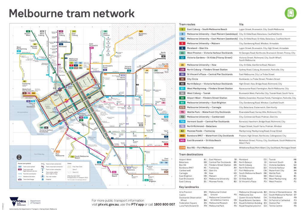
    Earlier in May, the Department of Transport released the first major update in four years to Melbourne’s tram network map. We don’t get very many official public transport map updates in Victoria, so when they do happen they are extra exciting! You can see a video version of this post using the link below: I’m…

  • Parklet map data now available

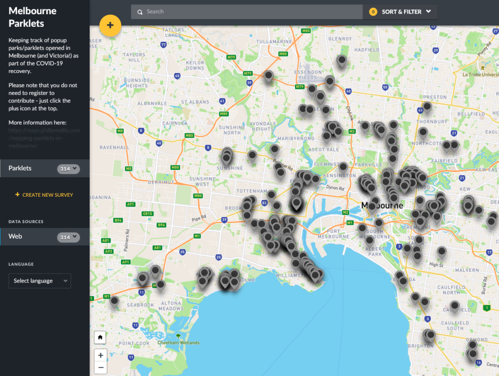
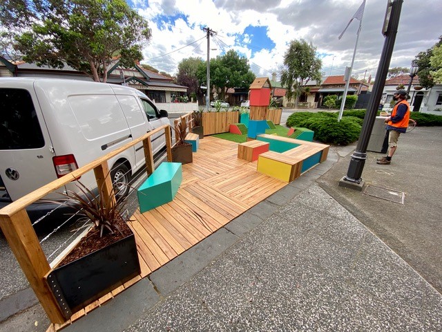
    The crowdsourced map of parklets across Melbourne and Victoria has been up for a few months now. At the time of writing, there are over 300 that people have added! Unfortunately as I’m in the middle of two rather large mapping projects at the moment, I don’t have the time to do this data justice…

  • Why Skybus should not be on a rail map

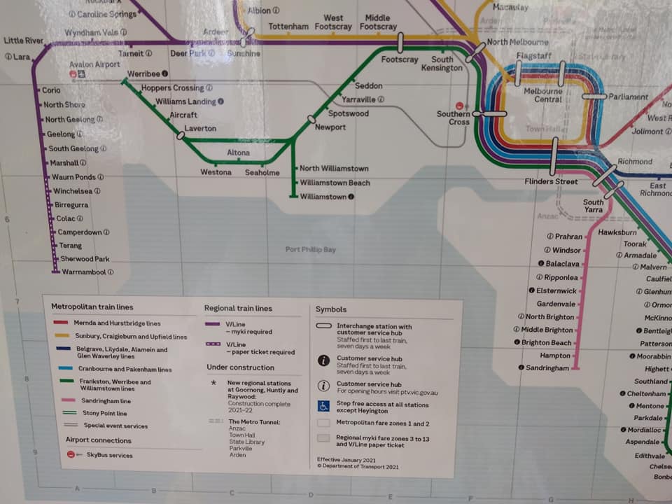
    This is my second post about the new version of the Victorian Rail Network Map that PTV have started distributing in trains – as shown in my previous post (thanks again to Mark Williams for the photos). I’ve already talked about my gripe with including things under construction on an operational map. My other main…

  • Why showing things under construction on a transport map is a bad idea

    I’d been considering writing a post on this topic for a while, inspired by the ongoing tradition of Sydney including things that don’t currently exist on their operational network maps.     But now it seems that PTV in Victoria have been inspired by our northern neighbours and applied this thinking to our own rail…

  • Mapping parklets in Melbourne

    Link to the map here. Over the past few months, there have been concerted efforts by the State Government and local governments across Victoria to support businesses in COVID-19 lockdown and recovery. One of the latest measures has been to support and/or install expanded space for outdoor dining and trading. What is a parklet? A…

  • Where to find bicycle maps for Melbourne

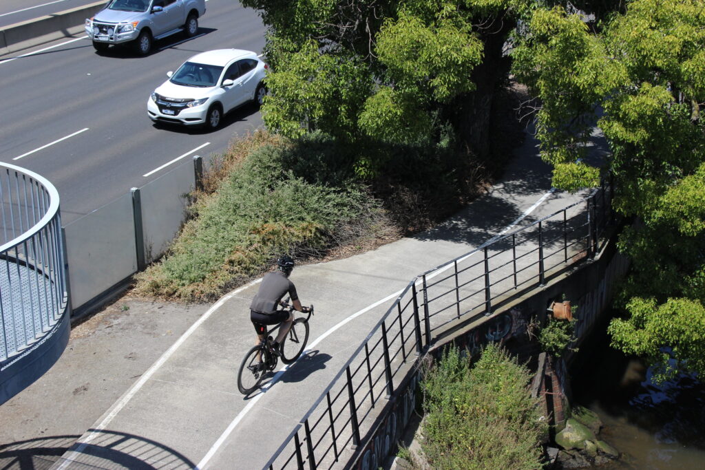
    I have posted before about journey planning for bikes over on my main blog. But what about maps showing bike routes and information in general? There are several great resources out there to help, most of them community-made. If you have to pick one, I think that the best overall is OpenCycleMap and its associated…

  • Mapping local words in Melbourne

    For my next project, I will be making a couple of maps to show vocabulary used to describe places or things that are specific to a particular location in Melbourne. There is existing ongoing research called the Linguistics Roadshow which already maps some of the few regionalisms that exist in Australia for things like potato…