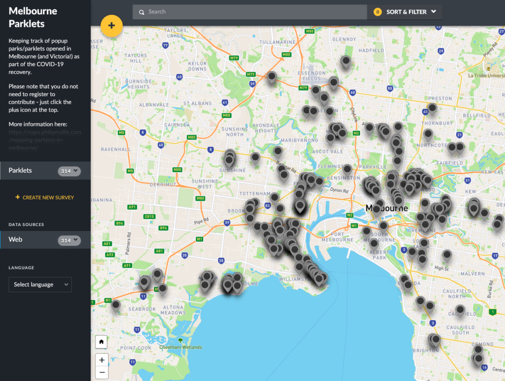
Parklet map data now available
The crowdsourced map of parklets across Melbourne and Victoria has been up for a few months now. At the time of writing, there are over…


The crowdsourced map of parklets across Melbourne and Victoria has been up for a few months now. At the time of writing, there are over…
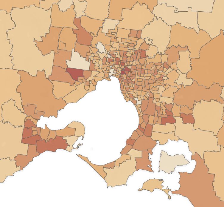
In the midst of this pandemic, there is not much current data available to know the exact impacts on our communities. As a result, I…
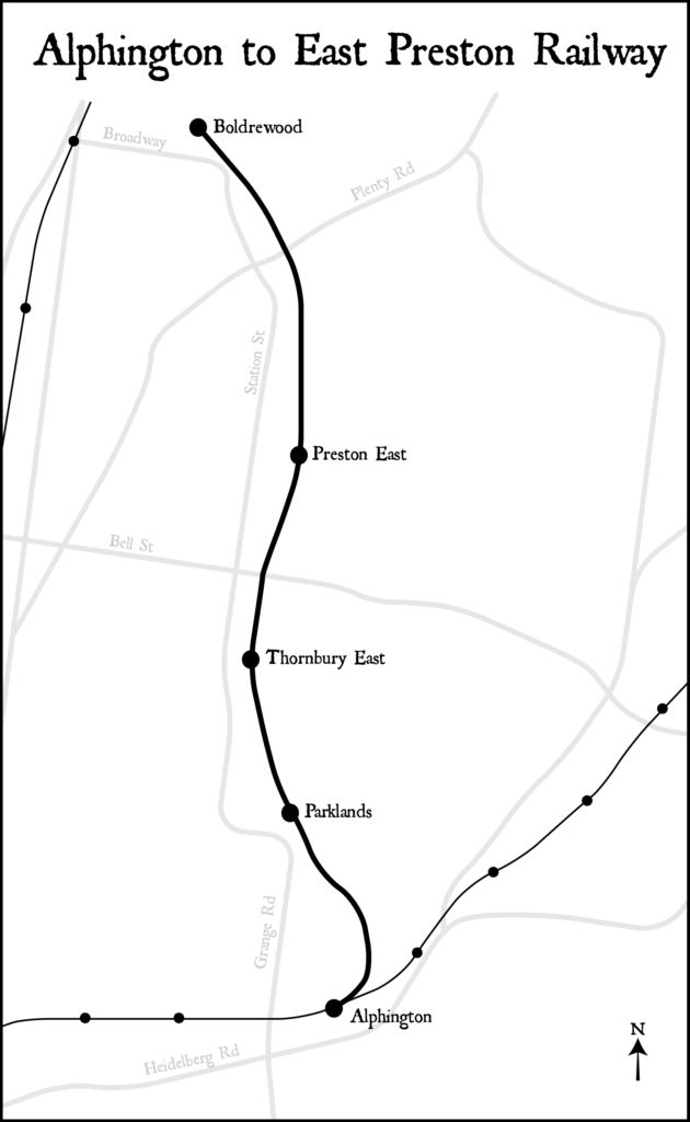
Recently I was looking through some old documents related to Alphington. Buried within Hansard from 1948 was a document entitled the Alphington to East Preston…

I spent a few days putting together a map that shows the distances between railway stations on Melbourne’s metropolitan rail network. The spacing has been…
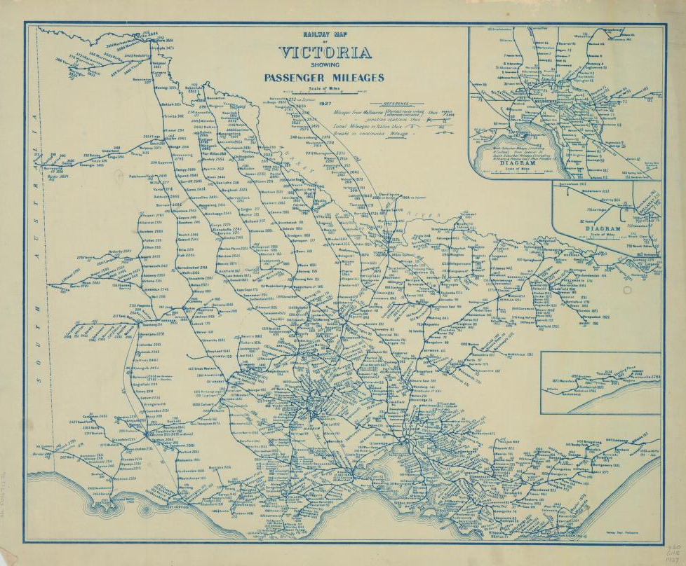
Victoria is not well-known for its transport maps in the same way as London or New York. Despite this lack of enduring iconic design, the…

After the publication of my schematic public transport map of Chernarus, there was some confusion about its design and purpose. Hopefully this post will clear…