• Works.
  • Biography.
  • Thoughts.
  • Shop.
  • Contact.
  • Blog
  • Contact
  • Portfolio
Maps by Philip Mallis

Melbourne

  • All
  • Bicycle
  • Fantasy
  • Historical
  • Melbourne
  • Public transport
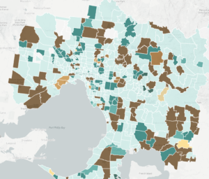
  • Melbourne suburb names etymology

    Melbourne
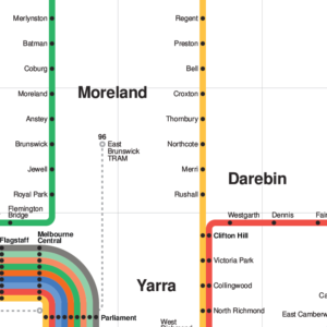
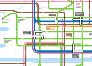
  • Vignelli Melbourne Rail Map

    Melbourne, Public transport
  • Eight coloured circles with the first letter of each proposed line in the 2050 Melbourne rail map against a white background

    Melbourne rail network 2050

    Fantasy, Melbourne
  • Screenshot of map showing blue dots against a street map of Melbourne with larger dots representing more people using a bus stop and smaller sizes for fewer people

    Victorian bus stop patronage

    Melbourne, Public transport
  • Close up of Melbourne Transport Map in CBD showing bus, train and tram lines.

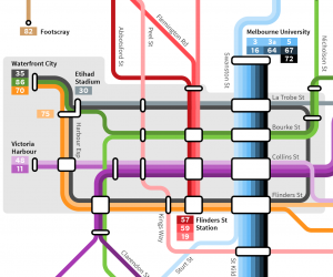
    Melbourne public transport map

    Bicycle, Melbourne, Public transport
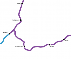
  • Melbourne rail network pocket map

    Melbourne, Public transport
  • Melbourne train map with Suburban Rail Loop

    Melbourne, Public transport
  • Melbourne tram map

    Melbourne, Public transport
  • Thumbnail of historical rail map of Melbourne showing Warburton and Healesville lines

    Historical melbourne rail map

    Fantasy, Historical, Melbourne, Public transport
  • Melbourne bicycle network schematic map

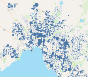
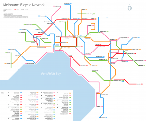
    Melbourne bicycle network map

    Bicycle, Melbourne

© Copyright Philip Mallis 2025. All Rights Reserved unless otherwise indicated.