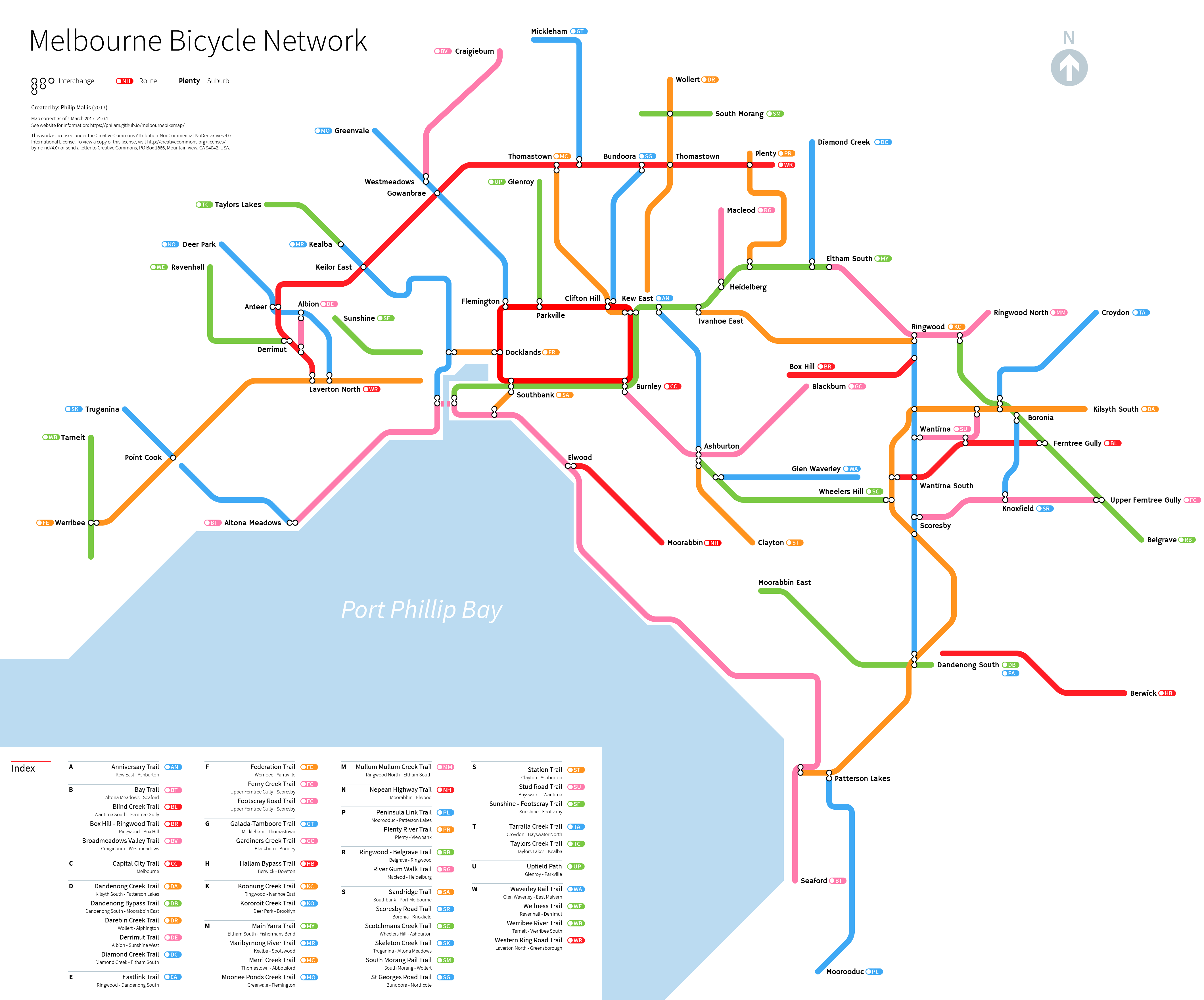
This map has been created to show Melbourne’s main bicycle routes in a different light. Existing maps concentrate on geographical accuracy rather than useability or visual design. This can make it difficult to plan routes strategically or see how parts of the network fit together (or don’t).
It serves three purposes:
- Strategic route planning, especially for long distances
- Highlight gaps in the network
- Provide a more legible and graphical representation of Melbourne’s major bicycle routes.
The Map

Routes
This is not a comprehensive map of every bicycle route in Melbourne. The map is only intended to depict major off-road bicycle routes in the metropolitan area of the city. As there is no definition of what a ‘major bicycle route’ entails, this necessitated some judgement calls on my part.
All major off-road routes are included. Generally, the small routes that do not serve a connecting purpose between other routes are not shown on the map. This is to reduce visual clutter and improve legibility.
If you think that I have missed anything, please let me know.
Other Notes
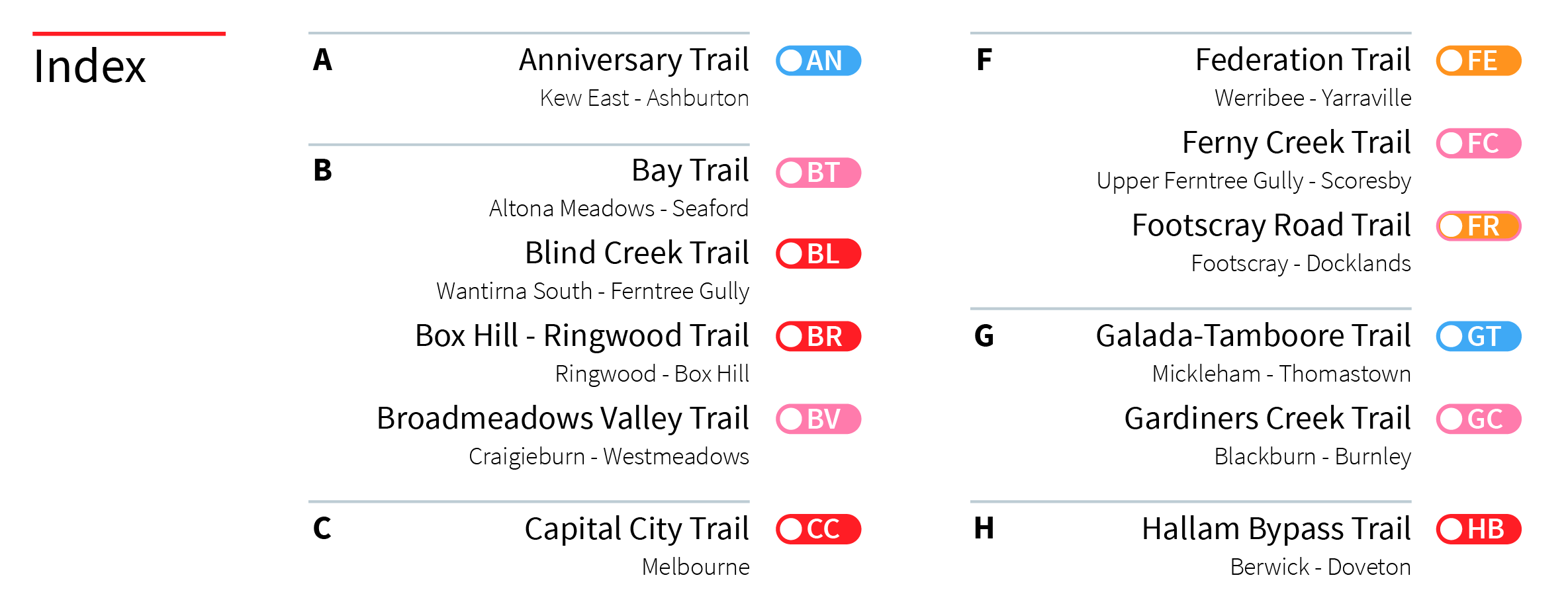
Abbreviations for trails are based off what seemes easiest to read and associate with a particular route rather than alphabetical order. The index shows each corresponding trail and name. I might introduce a clickable map in the future.
The map is obviously not to scale. It is based off 45 and 90 degree angles and straight lines on a 10px grid rather than true geographical location.
Locations where paths connect (‘interchanges’) are labelled except where space or design constraints prohibit. An earlier alpha version of the map had all suburbs labelled but this ended up being too messy.
Data
What I used to make the map:
Usage and Copyright
As stated on the main page, the map itself is licensed under a Creative Commons Attribution-NonCommercial-NoDerivatives 4.0 International license. Details about how and what is permitted in using this file are located on the Creative Commons website here.
Please also note that the version published on this site is low-resolution and contains a light watermark. For a high resolution and non-watermarked version, please contact me directly.
